NEW
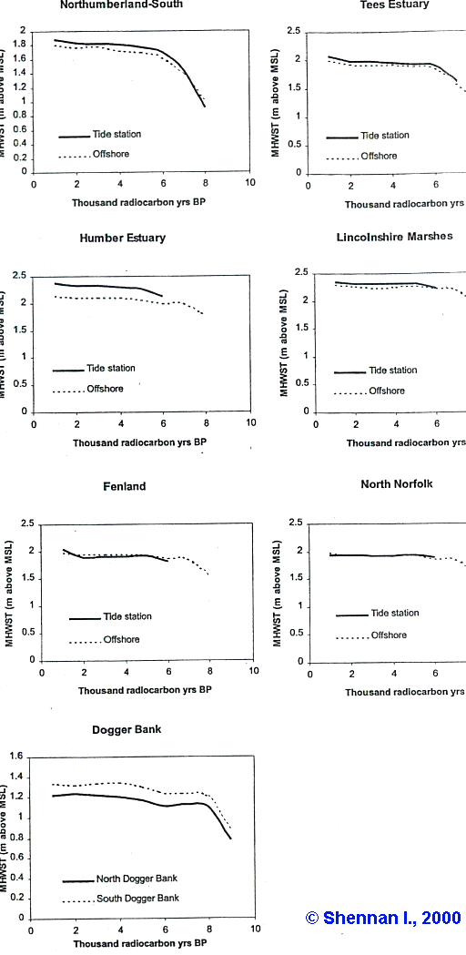
As one can see from this picture, the high tide level around at least
4400 Uncal BP or 3000 BCE was at almost the same
level (within 10-20 cm) as the present high tide level for a lot of locations
around the North Sea.
It is expected that one can extrapolate this for the regions around
Orkney and Ireland.
If this is in line with some present submerged megalithic sites, I don't know. Such as:
In Heritage Guide No.20 it is mentioned that at Strangford Lough the water was 3-4 m higher at 5000 years ago. So it seems not so easy as stated above!!! It looks that the dynamics are greater and even more depending on region. I will try to investigate more.