 Home
Home Up
Up Search
 Mail
Mail
NEW
Help with GPS Utility
- Using Map grid:
Input map grid coordinates (step 5 to 9) and transform them to
longitude/latitude
(step 10) and then determine the azimuthl (step 11 and 12). - Using Longitude/latitude:
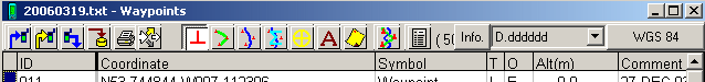
Change step 5 in: Change grid to 'D.ddddd' and 'WGS 84' and
input in step 8 and 9 the longitude and latitude and then proceed with
step 11.
- First of all download and install the GPS
Utility program.
- Start the program
- If using GPS Utility for the first time:
- Don't open any file yet
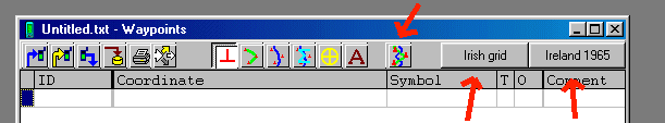
- Click 'Options', 'General'
- On right side a few grids are mentioned, click a 'Change'
button and
choice
'Irish grid'.
- Click 'File', 'New'
- Change grid to 'Irish grid' and 'Ireland 1965' (or for UK maps
use 'British grid' and 'Ord Srvy Grt Britn')
- Click
'Map' symbol
- Click 'Add/Drab Waypoint' symbol
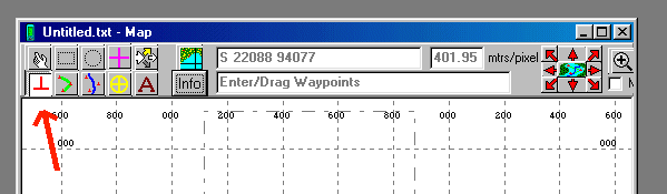
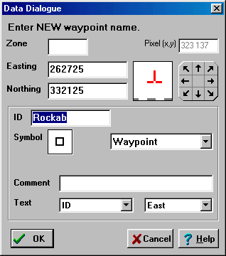
- Click
on the map to add waypoint, for this example fill in the below
waypoint
'Rockab' ('Zone' is empty!):
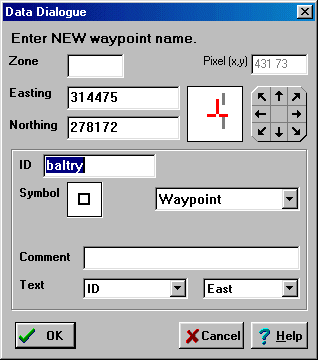
- Click
on the map to add waypoint, for this example fill in the below
waypoint
'baltry' ('Zone' is empty!):
- Change
grid to 'D.ddddd' (or 'Long-Lat' in newer versions of GPS Utility) and
'WGS 84'
This step is important, if one would kept it on another grid, the
bearing and distance would be based on a flat earth (instead of an
ellipsoid earth).
- Click 'Identify/Measure/Drag
Map or Reg. Pts.' and click on waypoint
'BALTRY'
and then drag to waypoint 'ROCKAB'
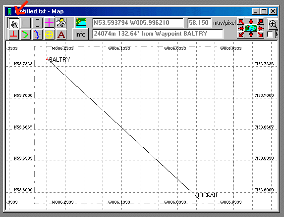
- Note
the azimuthl: 132.64°
Disclaimer and Copyright
HomeUpSearchMail
Last major content related changes: July 20, 2000